The Vatu Aurum Project
Discovering Fiji’s next gold epicentre
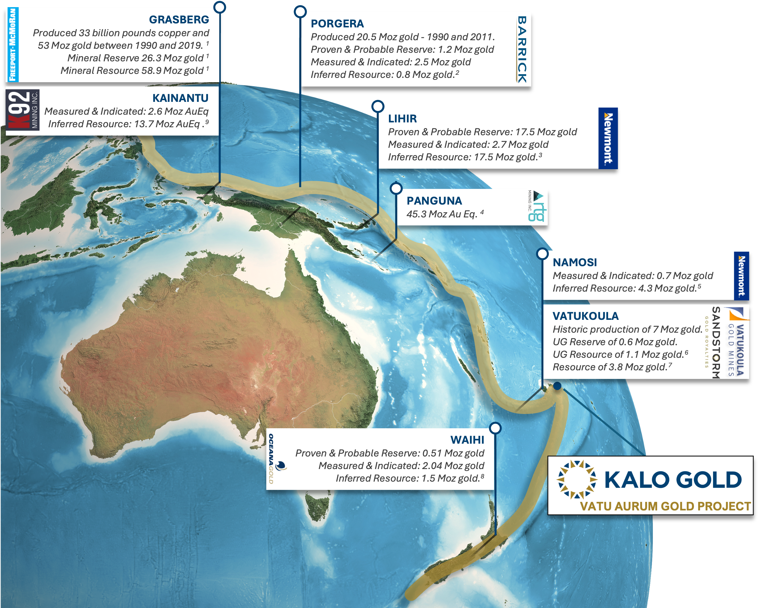
Ring of Fire
On Trend in the Prolific “Ring of Fire”
Attractive geology and footprint for large epithermal gold deposits with 100% ownership
Vastly Underexplored
Potential for multiple discoveries on a district scale land position
First Mover, Extensive In-Country Expertise
Over 10 years of established in-country relations and with two company owned diamond core rigs and available crew.
Safe Mining Friendly Jurisdiction
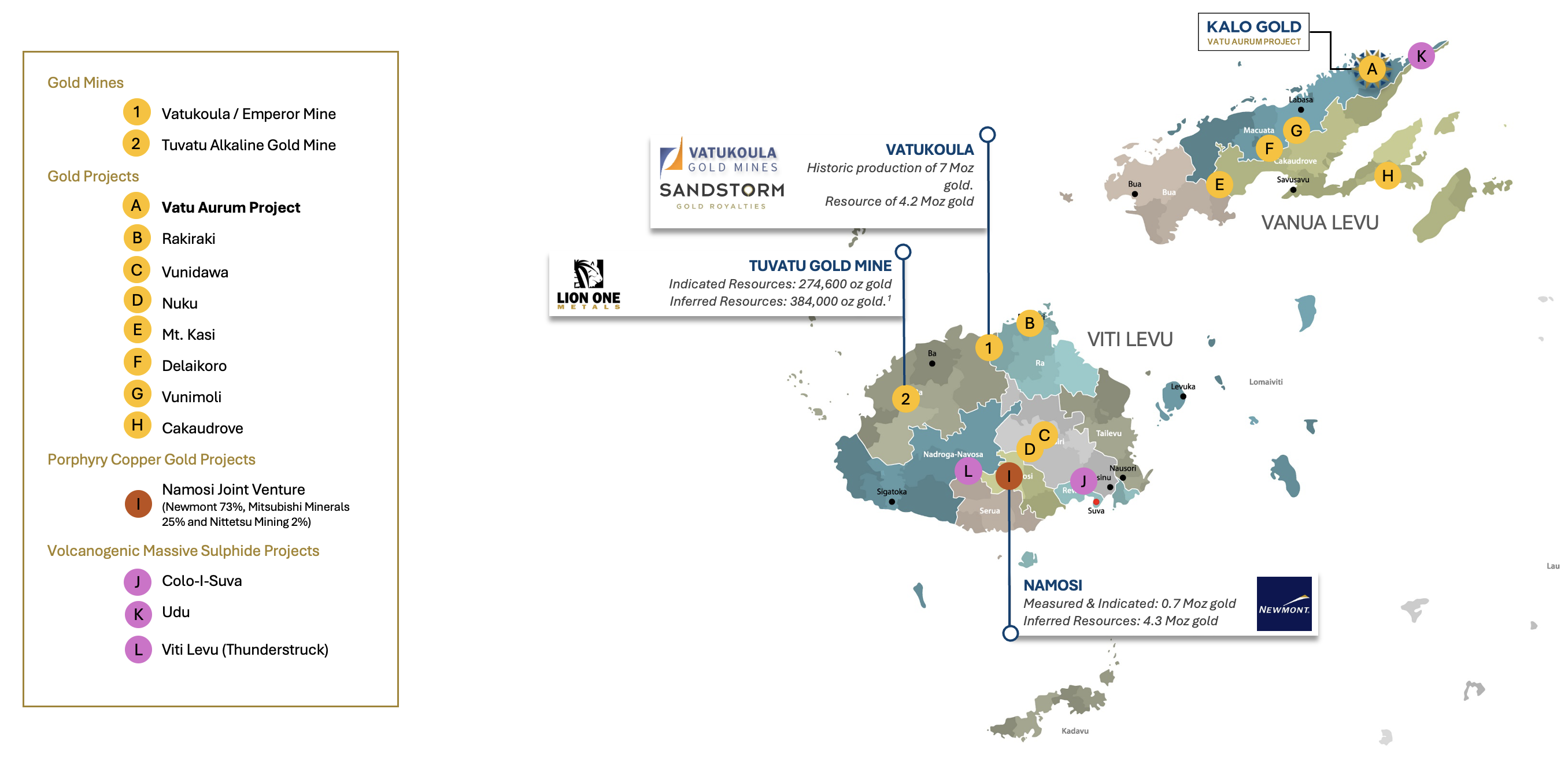
Long mining history in Fiji with proven deposits. Vatukoula Mine has produced >7 Moz to date and has been in operation for >87 years.
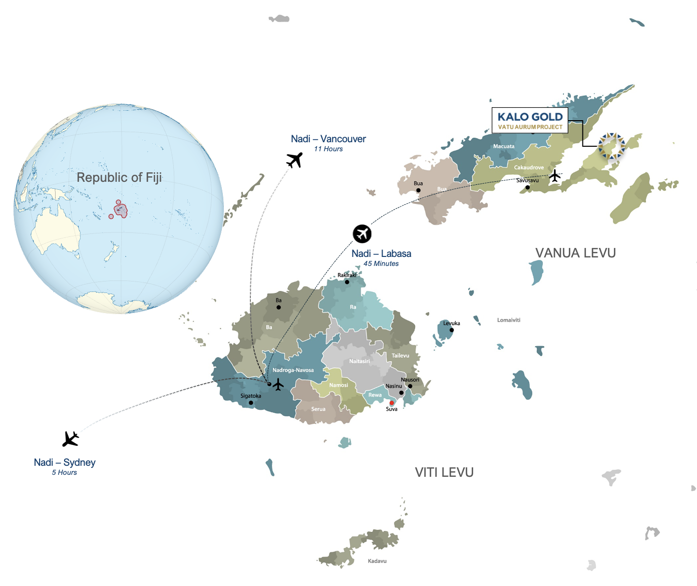
About Fiji
| Capital City | Suva |
| Official Languages | Fijian, English, Fiji Hindi, Rotuman |
| Government | Unitary Parliamentary Republic |
| Mining Act | Founded on British Law |
| Area | 18,274 km2 |
| Population | 926,276 (2018) |
| Currency | Fijian Dollar (FJD) |
| Time Zone | UTC +12 hours Vancouver +19 hours |
| Primary Exports | Oil, Fish, Beverages, Gems, Sugar, Clothing, Gold, Copper, Silver, Timber, Molasses, Coconut Oil, Mineral Water |
| Contributions from Mining | 2% of total GDP $120 million total value 2,000+ jobs Long mining history (>87 years) |
Fiji’s Regional Metallogeny
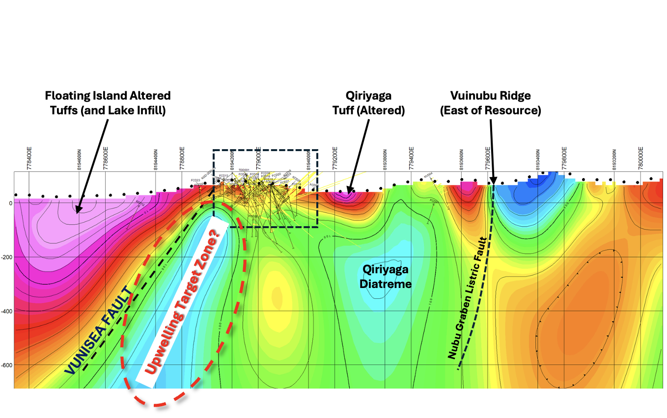
The Nubu Graben: a 28km Prospective Corridor
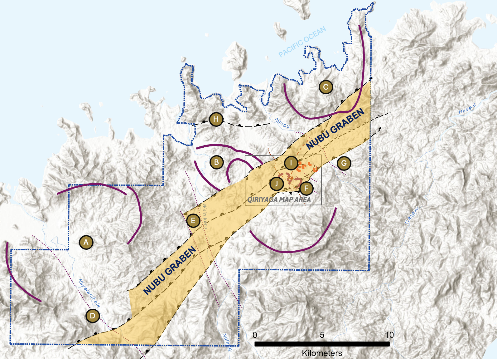
- Mineral targets are hosted within a >28km long extensional structure known as the “Nubu Graben”.
- This NE-SW striking structure was created by the downward drag of the Pacific Plate which then stretched the island crust.
- Upwelling fluids and magma emplaced the mineral wealth we see today.
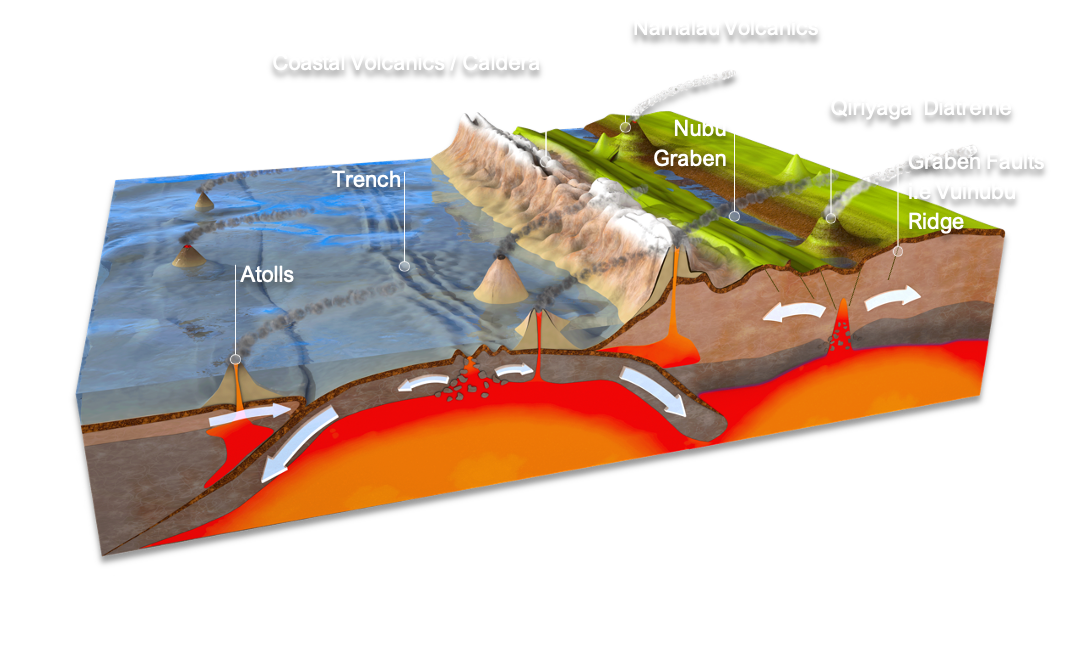
Conceptual section demonstrating the formation of key structures within the Vatu Aurum Project, and the magma upwelling zones contributing to mineralizing events.
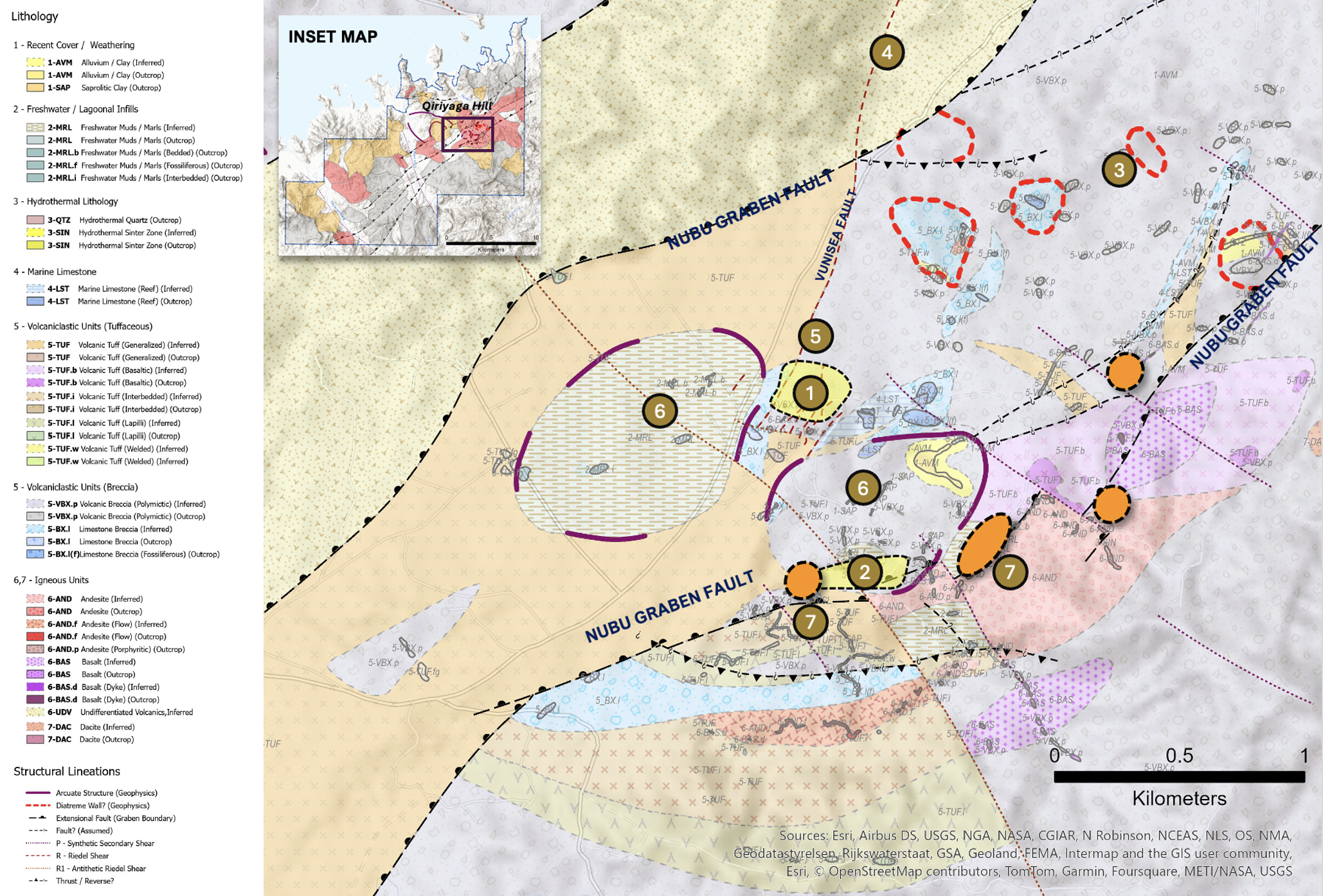
Qiriyaga Geology and Geochemistry Compilation
1 Refer to appendices of this presentation for full terms of reference for the resource calculation.
Phase 1 geological map built from a range of historical data was completed in early 2024 and shows lithology related to periods of volcanism and infill by marine and freshwater sediments.
This compilation exercise also helped to highlight several new potential target zones.
Map compilation is still in progress as more surface data is added, refining our understanding.
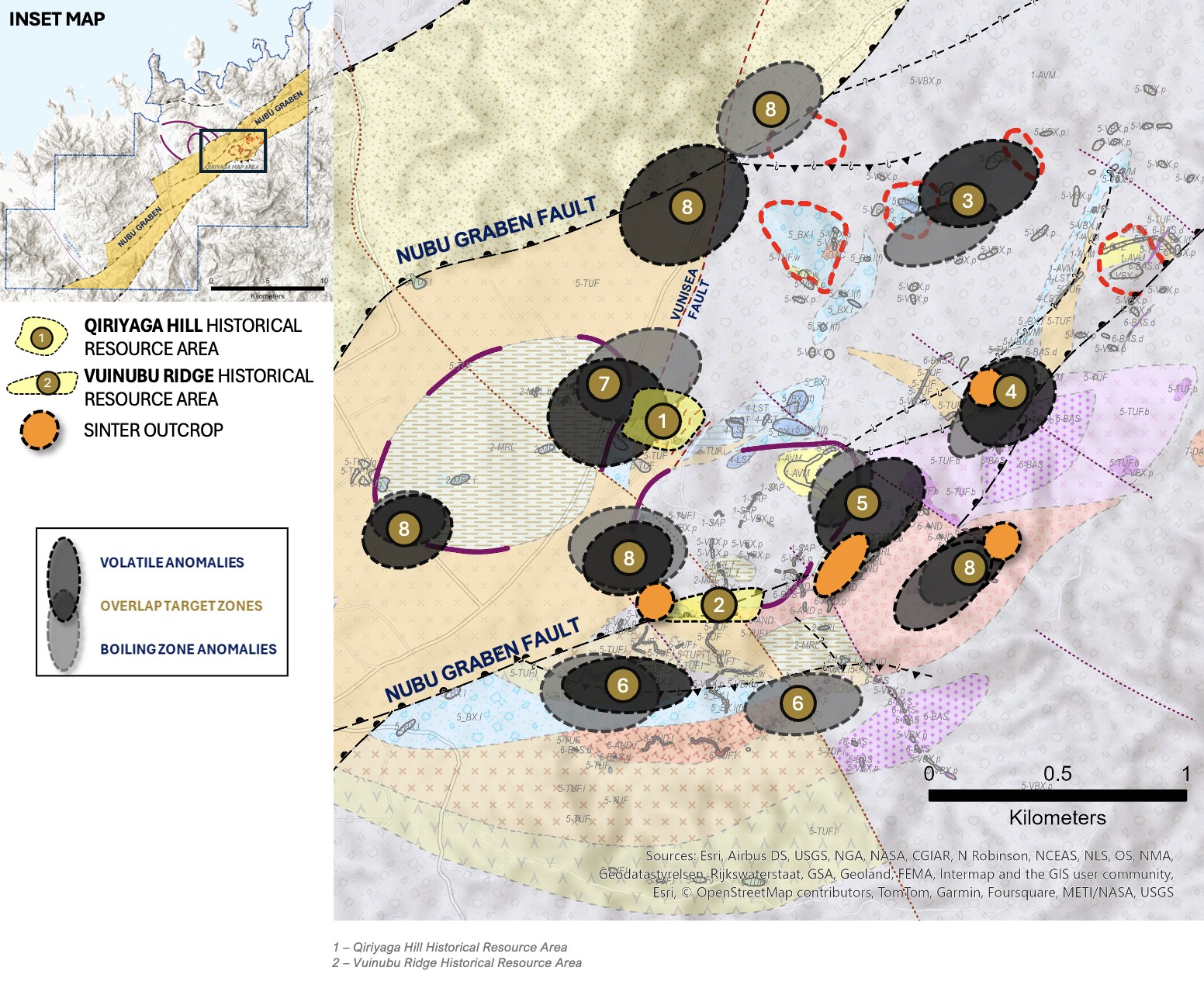
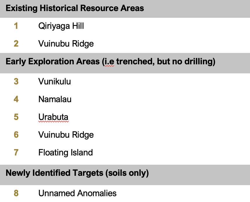
Overlap Zones
Plotting anomalous boiling level and volatile elements in soils can overlap, and the areas where they intersect can present the best areas for targeted field exploration.
The Qiriyaga area has several of these targets, where exploration ranges from nothing at all to trenching and preliminary drilling.
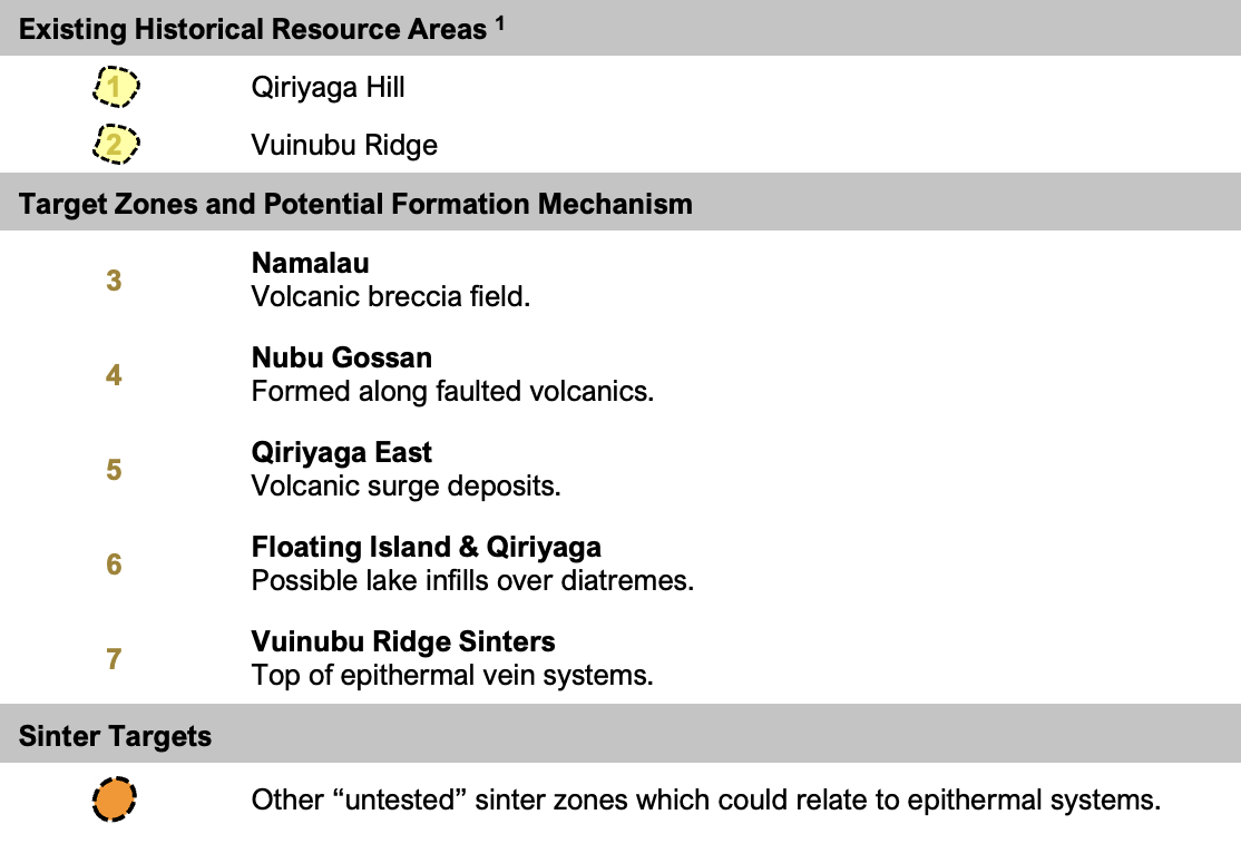
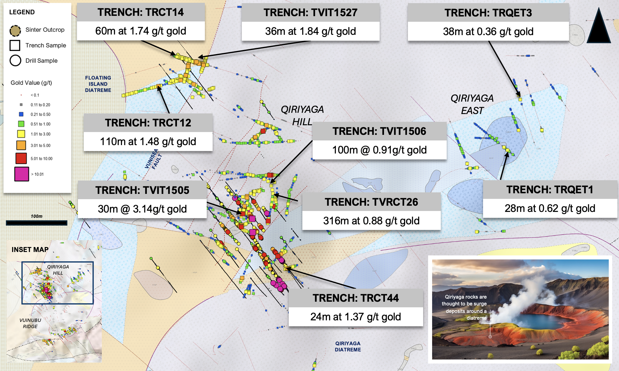
Qiriyaga Hill Prospect
Diatremes at Qiriyaga?
- Extensive gold mineralization within a 500m x 500m area.
- The mineralization is hosted in surge deposits blasted out of diatreme structures.
- Qiriyaga Hill sits between two circular geological and geophysical anomalies that could represent the “Qiriyaga” Diatreme to the south and the “Floating Island” Diatreme to the north.
- The root of the system will likely be offset from Qiriyaga Hill rather than lying directly under it.
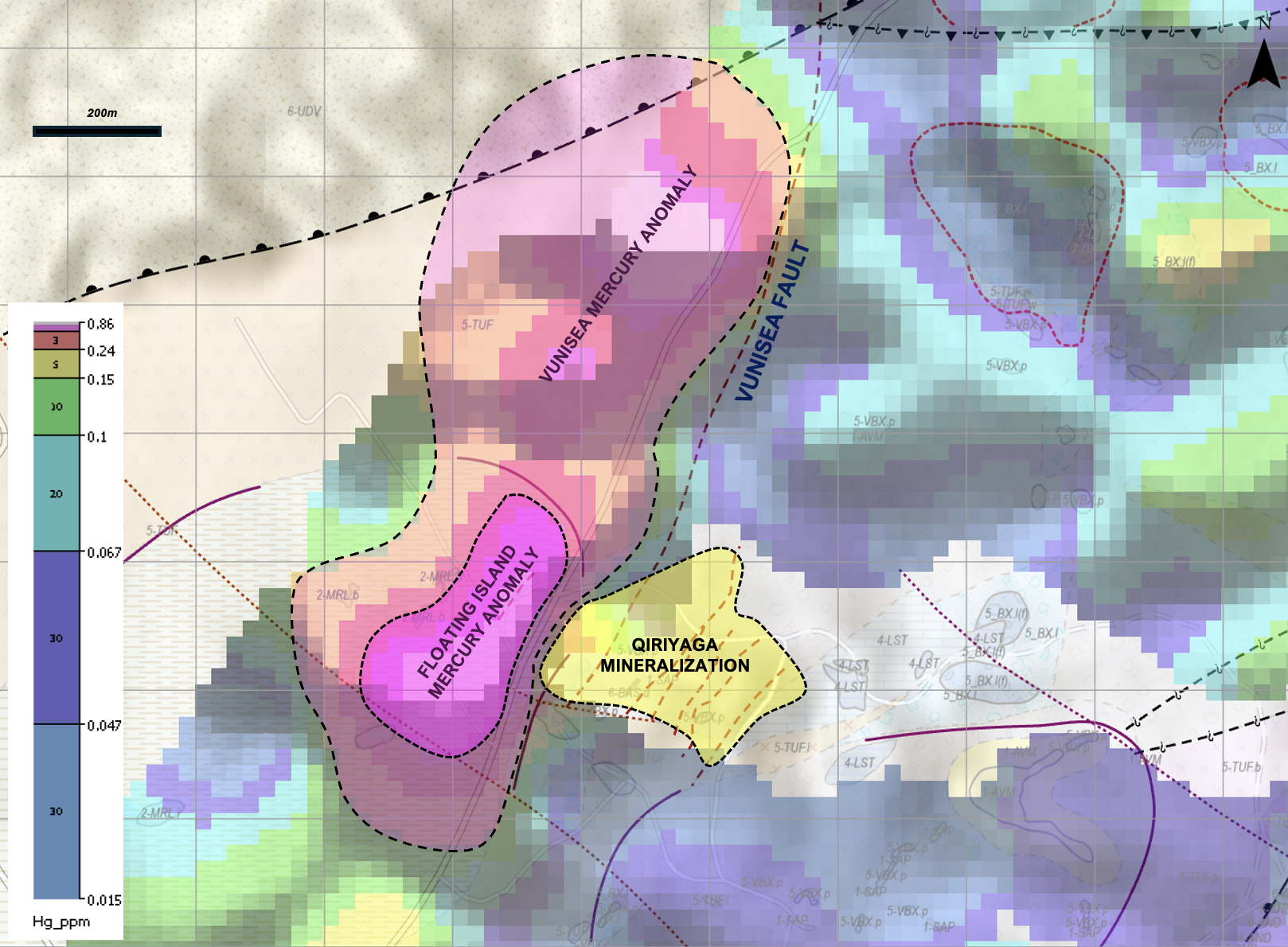
Vunisea Fault and Mercury Anomaly
This map shows a generalized concept for the Qiriyaga Hill area, using various geological observations.
The newly interpreted Vunisea Fault (observed in geophysics and geological mapping) follows a general trend of untested soil anomalies. The primary element is mercury but also associated antimony, thallium and arsenic which are indicators of high-level volatile zones at the top of an epithermal system.
This lineation could represent a “blind” fault that acted as a fluid or magmatic conduit, possibly even allowing lateral spread of mineralizing fluids from the Floating Island and Qiriyaga areas.
This feature persists for over 1km along strike. Outside of Qiriyaga, this anomaly has not been trench or drill tested.
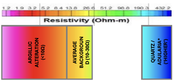
CSAMT Profile and Epithermal AU Model
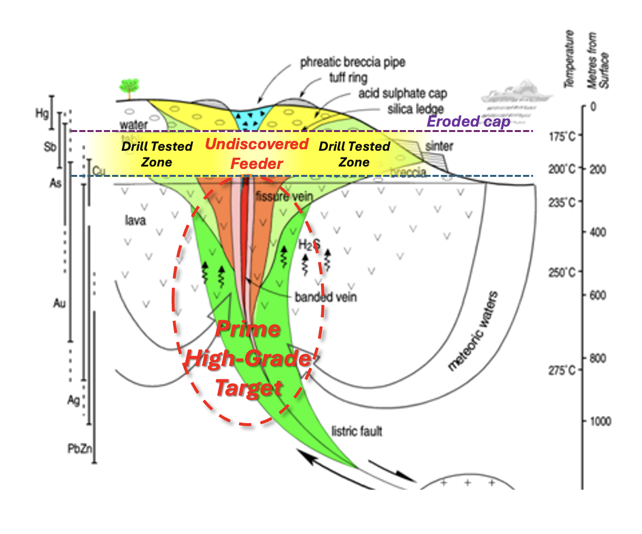
The Opportunity
Upwelling Target Zone & Prime High-Grade Target
Discover high to bonanza-grade gold in untested feeder targets.
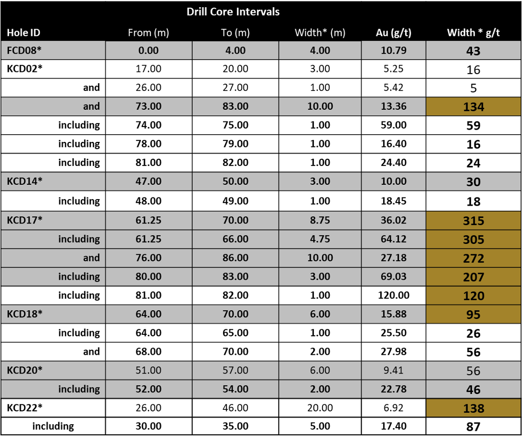
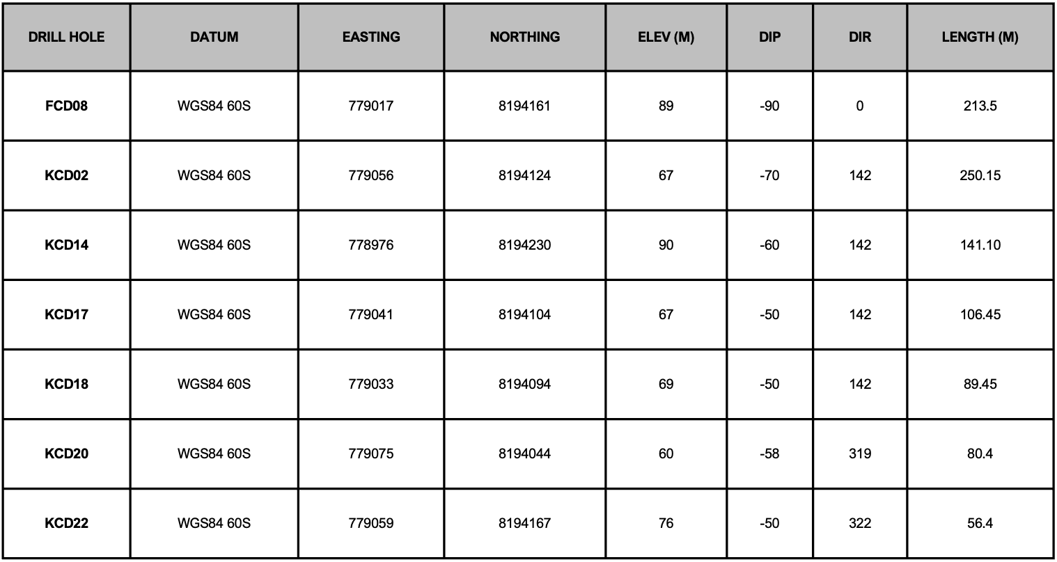
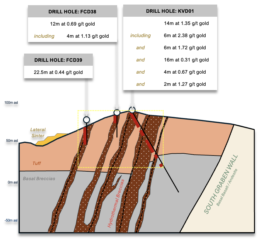
Qiriyaga Hill Drill Highlights
Vuinubu Ridge
Vuinubu Ridge Epithermal Veins
- Vuinubu Ridge straddle’s southern extensional fault of the Nubu Graben.
- The graben fault acts as a conduit for rising fluids.
- Coincidental high-grade soil, trench and drill results.
- Open along strike and at depth.
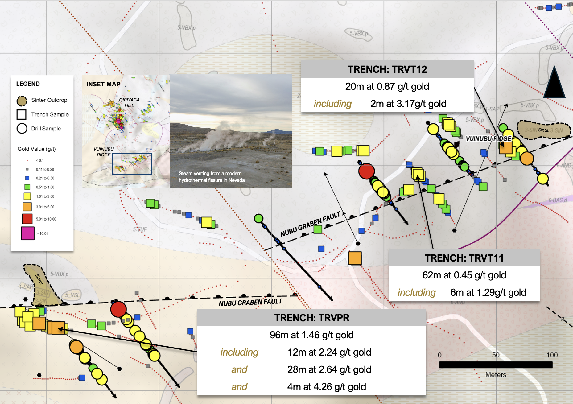
Vuinubu Drilling
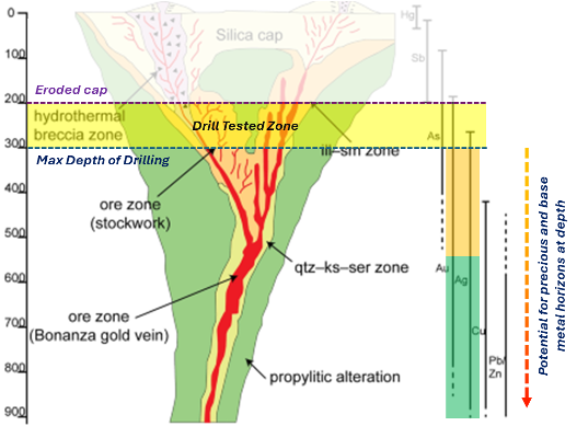
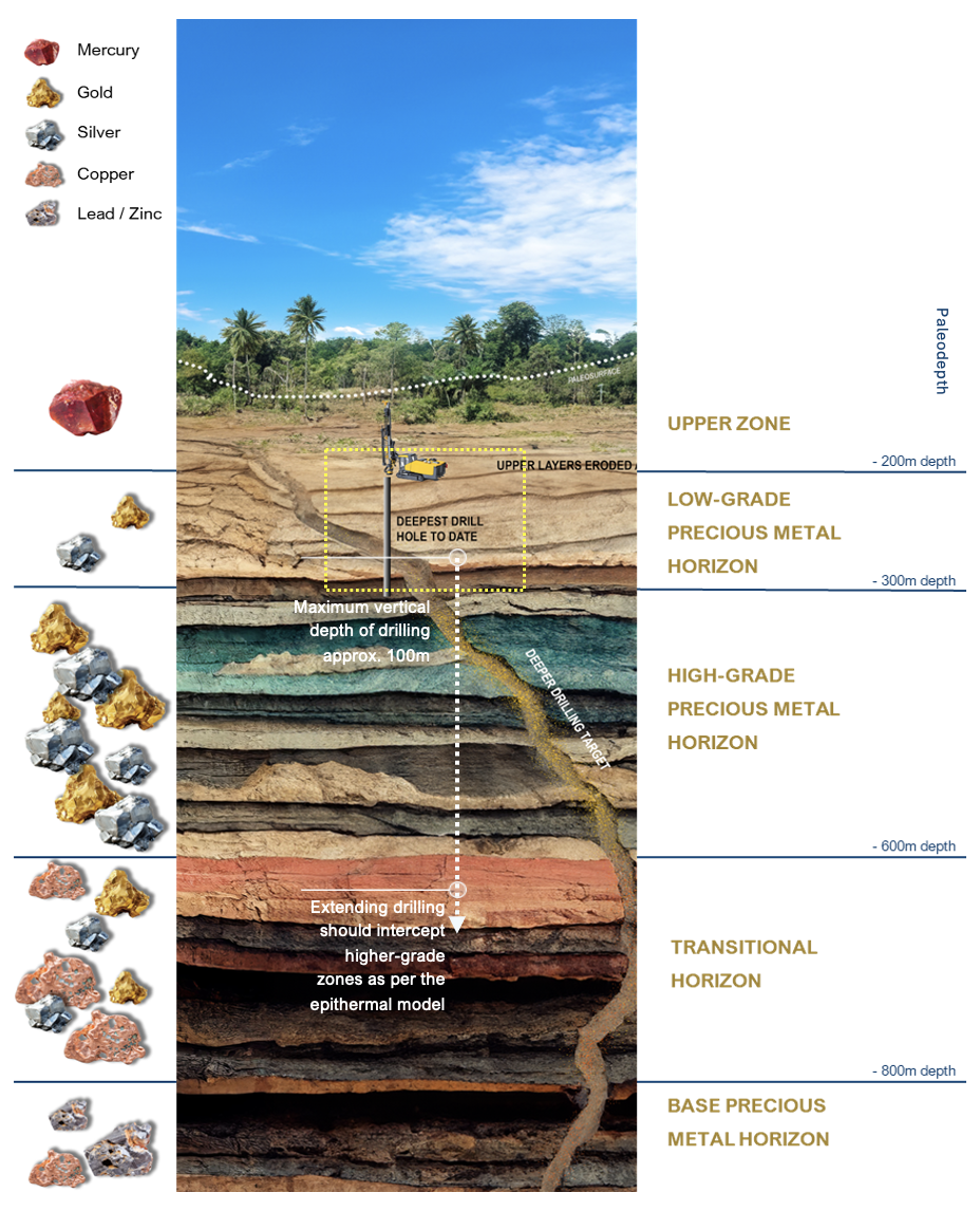
Drilling has intercepted gold-bearing hydrothermal breccias along the Nubu Graben Fault. Gold and the presence of sinter suggests the top of the system (see image to right) and gold grades could increase at depth.
The yellow box outlines the total depth of drilling to date, which is around 100m below surface. In the zonation model, this suggests that historical drilling has not reached the high-grade precious metal horizon and therefore deeper drilling is required to test this.
Ring of Fire
Moz = Million Ounces
¹ Freeport-McMoRan and Freeport-McMoRan 31 Dec 2022
² Barrick Gold Corp.
³ Newmont
⁴ RTG Mining Inc.
⁵ Newmont
⁶ Sandstorm Gold
⁷ Vatukoula Gold Mines
⁸ Oceana Gold
⁹ K92 Gold
Note: Details of other mines and resources is provided for information only and is not necessarily an indication of potential size, grades or production potential of Kalo projects
Fiji’s Regional Metallogeny
Moz = Million Ounces
¹ Lion One
Note: Details of other mines and resources is provided for information only and is not necessarily an indication of potential size, grades or production potential of Kalo projects
Qiriyaga Geology And Geochemistry Compilation
¹ Refer to appendices of the presentation for full terms of reference for the resource calculation.
Photo Gallery
The Company intends to continue its methodical exploration approach to advance the Project with next steps to include ongoing field exploration and importantly a remote spectral geology and structural studies to integrate remote sensing data with the current exploration database to define and prioritize possible alkaline related, epithermal gold targets and with subsequent drill testing to discover an economic gold deposit.


